
Finally I found some time to connect to Copernicus project satellites. After registration you can download - for free, however there is some daily limit - tons of high quality imagery from Sentinel family of satellites.
As a test, I downloaded a couple of images of my country, did some sorting on axis urbanized/non-urbanized areas, and processed the image of Prague with trained neural network.
With a help of Python and a keras library, it was a piece of cake: about 60 lines of code. Most time took handling with outdated Copernicus API documentation.
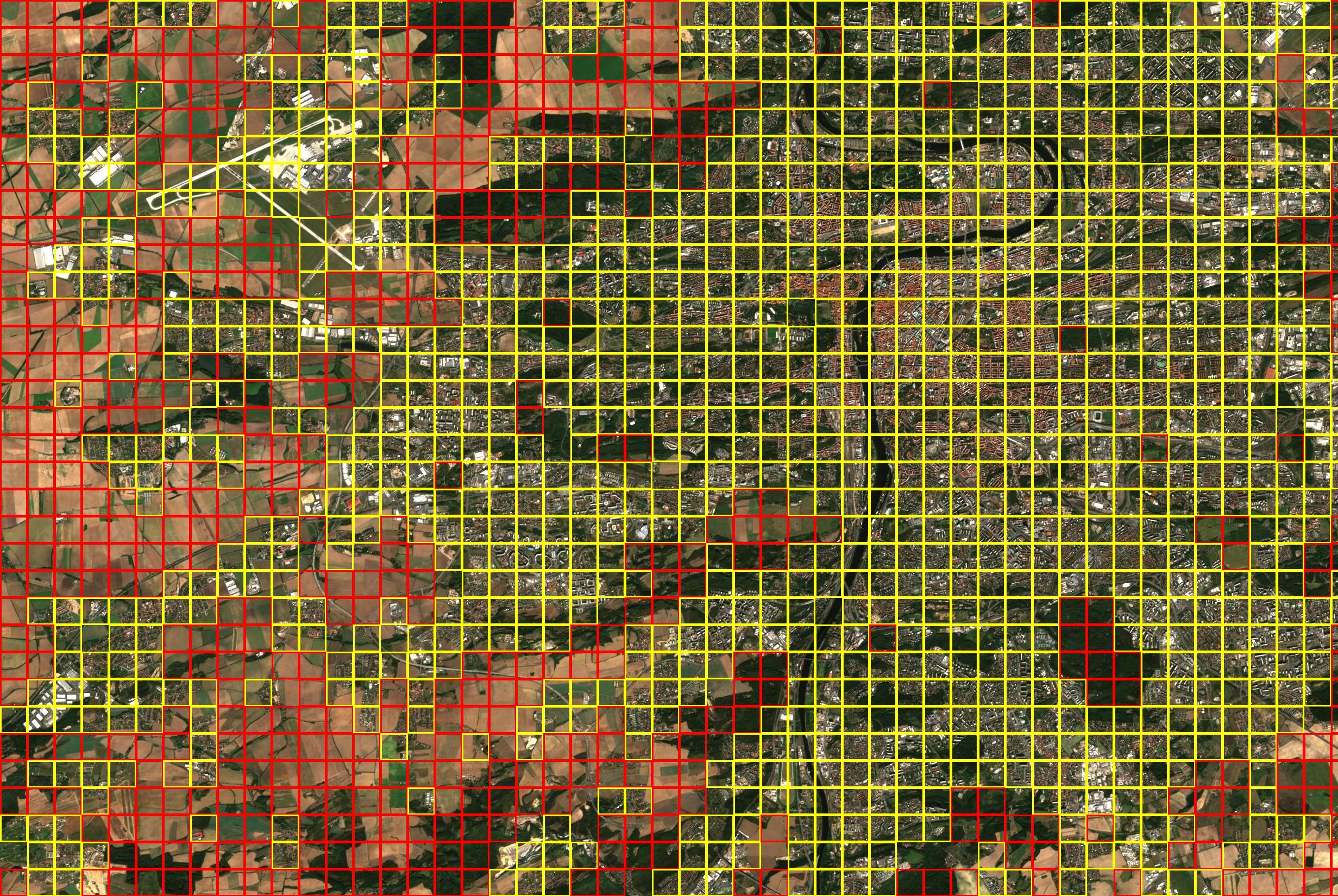
Here is a result: yellow squares are urbanized areas, red squares nonurbanized. Pretty good accuracy for a training set containing only(!) 200 manually sorted pictures.
Další posty: